MOUNT KILIMANJARO
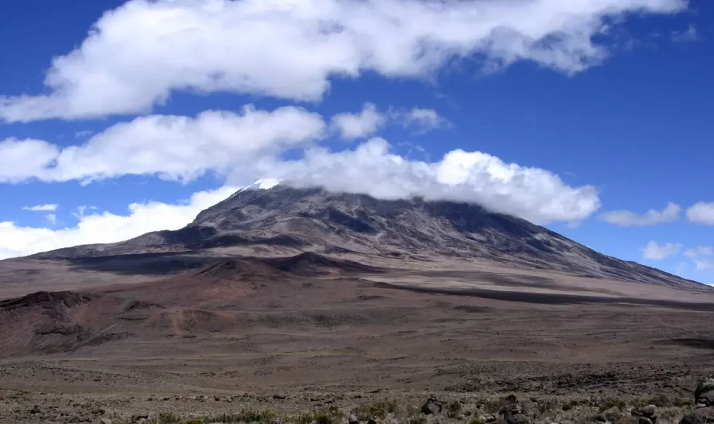
Mount Kilimanjaro, which stands at 5895 meters and is the highest free-standing peak in the world, is located in Tanzania. It is the highest mountain in Africa. Despite its height, Kilimanjaro is one of the highest mountains that is easiest to reach, with most climbers needing only a walking stick, appropriate clothes, and a strong will to reach the top (Uhuru Peak).
The ascent of Mount Kilimanjaro is a virtual tour of the world’s climates, taking climbers from the lower slopes’ tropical rain forest to the alpine heath, then to an almost bare alpine desert and, eventually, to the wintry Arctic summit, which is only 3 degrees south of the equator.
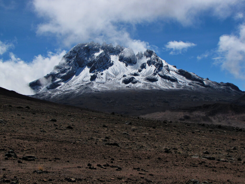
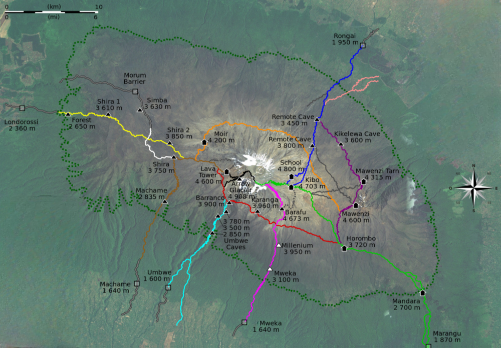
There are six established routes to climb Mount Kilimanjaro: Lemosho (Londorossi), Machame, Marangu, Rongai, Shira, and Umbwe. The length of the Kilimanjaro climb might range from four to six nights on the mountain, depending on the route chosen. The Lemosho and Shira routes approach from West of the mountain. The Machame, Marangu and Umbwe routes all approach from South. The Rongai route approaches from North near Kenya. All routes except Marangu and Rongai descend via Mweka. The Marangu and Machame routes are the most popular with Marangu being the easiest of all. While camping is the only form of lodging on the Machame Route, alpine huts are used on the Marangu Route. There is no need for technical equipment on these routes, and you will be accompanied on your climb by knowledgeable guides and porters.
MOUNT MERU
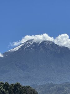
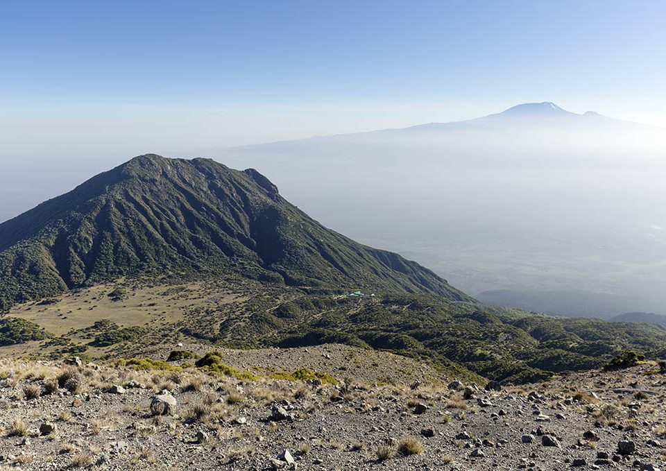
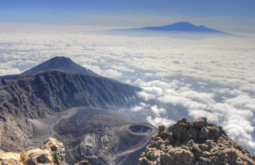
Mount Meru is a dormant stratovolcano located 70 kilometers west of Mount Kilimanjaro in the Southeast Arusha Region, Tanzania. At a height of 4,562 meters (14,968 ft), it is visible from Mount Kilimanjaro on a clear day and is the fifth-highest of the highest mountain peaks of Africa, dependent on definition.
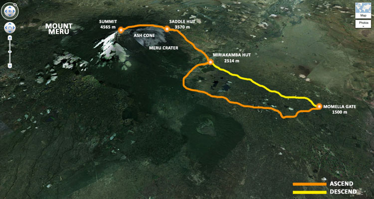
Mount Meru is located just north of the city of Arusha, in the Arusha Region of Tanzania. It is the second-highest mountain in Tanzania, after Mount Kilimanjaro. Mount Meru is also the highest mountain/point in Arusha Region. The Momella route – which starts at Momella gate, on the eastern side of the mountain – is used to climb Mount Meru.
Much of its bulk was lost about 7,800 years ago due to a summit collapse. Mount Meru most recently had a minor eruption in 1910. The several small cones and craters seen in the vicinity probably reflect numerous episodes of volcanic activity. Mount Meru’s caldera is 3.5 kilometers (2.2 miles) wide.
Mount Meru is the topographic centerpiece of Arusha National Park. Its fertile slopes rise above the surrounding savanna and support a forest that hosts diverse wildlife, including nearly 400 species of birds, and also monkeys and leopards.
The movie Hatari! was filmed at the foot of Mountain Meru.